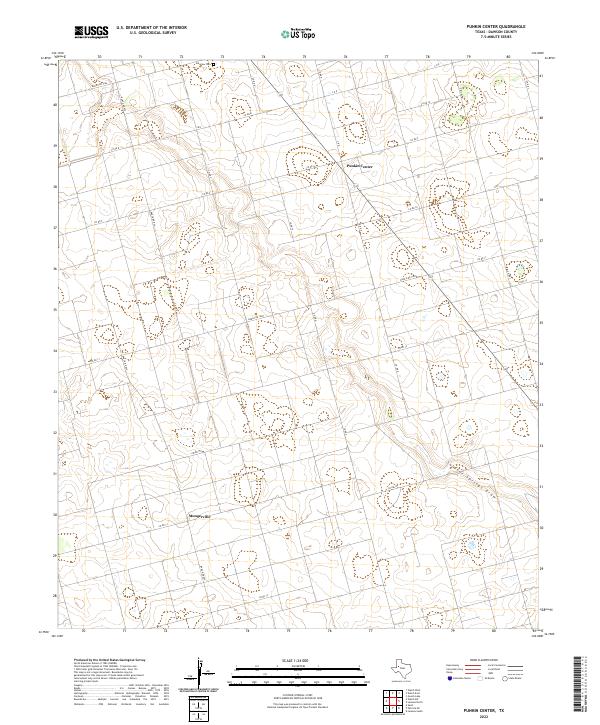
2022 Map of Punkin Center
USGS Topo · Published 2022About this map
Punkin Center and Mungerville anchor this high-plains landscape in Dawson County, where a rigid grid of ranch and county roads defines the West Texas terrain. The map captures a rural environment structured around agriculture and cattle, with extensive routes like Ranch Rd 1066 and Ranch Rd 829 providing the primary transit network. In the northeast, Fairview Cem serves as a localized point of historical and genealogical interest, marking the endurance of early community footprints. The natural drainage of Sulphur Springs Draw cuts a subtle, meandering path across the southeast, contrasting with the straight-line geometry of the local property boundaries and thoroughfares. This layout reflects the systematic 20th-century development of the Llano Estacado, where wide-open spaces are meticulously partitioned for production.
Find a feature on this map
22 named features on this map. Tap any name to fly to it.
Don’t see what you’re looking for? This feature index may not catch every label — zoom into the map to look around manually.
Map Details
Editions of this 2022 Punkin Center Map
This is the sole edition of this map. No revisions or reprints were ever made.
Other maps of this area

1954 · Hobbs
USGS Topo · 1:250,000

1954 · Big Spring
USGS Topo · 1:250,000

1958 · Big Spring
USGS Topo · 1:250,000

1958 · Hobbs
USGS Topo · 1:250,000

1968 · Lamesa North
USGS Topo · 1:24,000

1969 · Welch East
USGS Topo · 1:24,000

1969 · Gooch Lake
USGS Topo · 1:24,000

1969 · Welch SW
USGS Topo · 1:24,000

1969 · Punkin Center
USGS Topo · 1:24,000
1969 · Welch West
USGS Topo · 1:24,000