Loading...
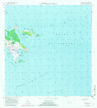
Loading map...1946 Map of Punta Puerca
USGS Topo · Published 1946About this map
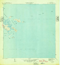
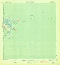
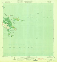
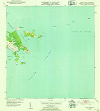
The U. S. Naval Reservation dominates this coastal survey of Ceiba, capturing a strategic landscape of the eastern Puerto Rican shoreline shortly after World War II. The map details the intricate geography of Punta Puerca and the surrounding waters, including the Bahía de Puerca and the expansive Sonda de Vieques. Small outposts like Machos and Guayacan are situated within the military-controlled grounds, while a Faro or lighthouse marks the maritime approach near Isla Cabeza de Perro.
Find a feature on this map
23 named features on this map. Tap any name to fly to it.
Don’t see what you’re looking for? This feature index may not catch every label — zoom into the map to look around manually.
Map Details
Date Portrayed1946
Date Published1946
PublisherU.S. Geological Survey
Map TypeTopographic
Scale1:30,000
Physical Dimensions20 x 21.9 inches
Editions of this 1946 Punta Puerca Map
3 editions found
Historical Maps of Machos Through Time
3 maps found
Featured Locations
Source Details
SourceU.S. Geological Survey
CopyrightPublic Domain