
1949 Map of Purdy
USGS Topo · Published 1952About this map
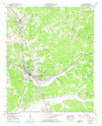
The Gulf Mobile and Ohio railroad corridor serves as the industrial spine for this McNairy County landscape, connecting the primary settlements of Bethel Springs and Selmer. This mid-century survey reveals a deeply dissected terrain where the Tennessee Valley Divide snakes through the eastern half of the map, separating drainage systems like Cypress Creek from the eastern hollows. The rural character of the area is underscored by the dense placement of community anchors, including the County Farm and a network of local houses of worship such as Bethesda Church and Rural Hill Church. A notable engineering feature is the Cypress Drainage Canal, which illustrates historical efforts to manage the low-lying wetlands west of the main rail line. Smaller settlements like Purdy and Falcon maintain their identity through local landmarks, including the Purdy Cemetery and Falcon Church, providing a clear view of Tennessee's rural settlement patterns during the late 1940s.
Find a feature on this map
87 named features on this map. Tap any name to fly to it.
Don’t see what you’re looking for? This feature index may not catch every label — zoom into the map to look around manually.
Map Details
Editions of this 1949 Purdy Map
3 editions found
Other maps of this area

1936 · Leapwood
USGS Topo · 1:24,000

1936 · Purdy
USGS Topo · 1:24,000

1936 · Stantonville
USGS Topo · 1:24,000

1936 · Michie
USGS Topo · 1:24,000

1936 · Mt. Peter
USGS Topo · 1:24,000

1949 · Leapwood
USGS Topo · 1:24,000

1949 · Mt. Peter
USGS Topo · 1:24,000

1949 · Stantonville
USGS Topo · 1:24,000

1949 · Michie
USGS Topo · 1:24,000

1951 · Chewalla
USGS Topo · 1:24,000