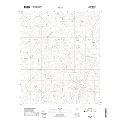
2018 Map of Purvis
USGS Topo · Published 2018About this map
Purvis serves as the primary hub of activity on this Lamar County landscape, situated where several regional roads and rail lines converge. The surrounding terrain is characterized by a dense network of creek drainages and wetlands, such as Allens Reed Brake and Daniels Reed Brake, which weave through a series of named elevations including Sheep Stomp Hill, Black Creek Hill, and Anderson Hill. This survey highlights a rural settlement pattern defined by numerous small family cemeteries and hilltop communities like Pine Ridge and Okahola.
Find a feature on this map
137 named features on this map. Tap any name to fly to it.
Don’t see what you’re looking for? This feature index may not catch every label — zoom into the map to look around manually.
Map Details
Editions of this 2018 Purvis Map
This is the sole edition of this map. No revisions or reprints were ever made.
Other maps of this area

1953 · Hattiesburg
USGS Topo · 1:250,000

1958 · Hattiesburg
USGS Topo · 1:250,000

1963 · Rock Hill
USGS Topo · 1:24,000

1964 · Purvis
USGS Topo · 1:24,000

1964 · Hattiesburg
USGS Topo · 1:24,000

1964 · Lumberton
USGS Topo · 1:24,000

1965 · Hattiesburg SW
USGS Topo · 1:24,000

1965 · Dixie
USGS Topo · 1:24,000
1969 · Baxterville
USGS Topo · 1:24,000

1969 · Baxterville NE
USGS Topo · 1:24,000