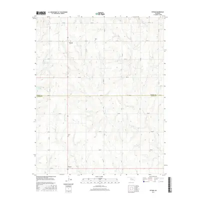
2016 Map of Putnam
USGS Topo · Published 2016About this map
Putnam sits at the intersection of a sprawling rural grid in this 2016 survey, representing a classic Western Oklahoma agricultural landscape. The area is defined by the headwaters of several drainages, including Horse Cr, Deer Cr, and Beaver Cr, which feed into localized catchments such as Ernst Reservoir and Barnitz Creek Site 101 Reservoir. The terrain is etched with a dense network of sectional roads, from E0790 Rd in the north to E0870 Rd at the southern edge, illustrating the organized land use of the High Plains.
Find a feature on this map
32 named features on this map. Tap any name to fly to it.
Don’t see what you’re looking for? This feature index may not catch every label — zoom into the map to look around manually.
Map Details
Editions of this 2016 Putnam Map
This is the sole edition of this map. No revisions or reprints were ever made.
Other maps of this area

1955 · Clinton
USGS Topo · 1:250,000

1957 · Clinton
USGS Topo · 1:250,000

1957 · Butler
USGS Topo · 1:62,500

1957 · Clinton
USGS Topo · 1:62,500

1962 · Putnam
USGS Topo · 1:62,500

1962 · Aledo
USGS Topo · 1:62,500

1976 · Butler NE
USGS Topo · 1:24,000

1976 · Clinton NW
USGS Topo · 1:24,000

1976 · Clinton NE
USGS Topo · 1:24,000
1983 · Custer City
USGS Topo · 1:24,000