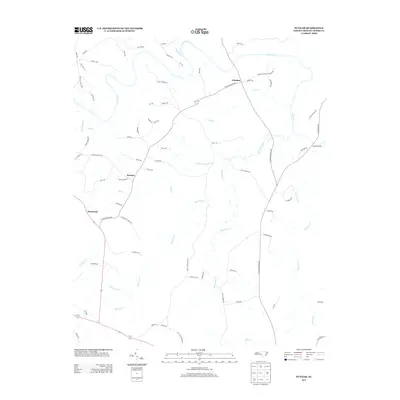
2013 Map of Putnam
USGS Topo · Published 2013About this map
Deep River winds through the northern portion of this Moore County landscape, serving as a primary geographical anchor for the rural communities of Glendon and Putnam. The terrain is defined by an intricate network of waterways, including McLendons Cr and Richland Cr, which drain the varied topography. The settlement of Parkwood sits to the west, connected by a web of local routes like Putnam Glendon Rd. Many road names, such as Seawell Rd, Paschal Rd, and Garriss Rd, reflect the long-standing family lineages that have shaped this region. Smaller tributaries like Persimmon Glade Br and Tysons Cr further detail the rural character of the area, providing a granular look at the local geography during the early twenty-first century.
Find a feature on this map
74 named features on this map. Tap any name to fly to it.
Don’t see what you’re looking for? This feature index may not catch every label — zoom into the map to look around manually.
Map Details
Editions of this 2013 Putnam Map
This is the sole edition of this map. No revisions or reprints were ever made.
Other maps of this area

1942 · Troy
USGS Topo · 1:125,000

1953 · Raleigh
USGS Topo · 1:250,000

1954 · Raleigh
USGS Topo · 1:250,000

1968 · Bennett
USGS Topo · 1:24,000

1970 · Goldston
USGS Topo · 1:24,000

1970 · Bear Creek
USGS Topo · 1:24,000
1974 · Carthage
USGS Topo · 1:24,000

1974 · White Hill
USGS Topo · 1:24,000
1974 · Vass
USGS Topo · 1:24,000

1974 · Putnam
USGS Topo · 1:24,000