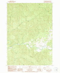
1987 Map of Putnam Valley
USGS Topo · Published 1987About this map
Putnam Valley is centered around the meandering path of Elk Creek, which serves as the primary drainage for this part of Douglas County. In the mid-1980s, the small settlement of Sunnydale stood as the local focal point, surrounded by a complex system of ridges and high points such as Lookout Mtn and Deadman Butte. The landscape is deeply carved by numerous tributaries including Thistleburn Creek and Tom Folley Creek, reflecting a region defined by its timbered slopes and creek-bottom access. Local industry and infrastructure are represented by a Quarry and a prominent Powerline corridor that cuts through the southern sections. Genealogists and local historians can locate several Cem sites, likely holding the family histories of the early homesteaders who settled along the creek banks and ridges like Allen Ridge.
Find a feature on this map
27 named features on this map. Tap any name to fly to it.
Don’t see what you’re looking for? This feature index may not catch every label — zoom into the map to look around manually.
Map Details
Editions of this 1987 Putnam Valley Map
This is the sole edition of this map. No revisions or reprints were ever made.
Other maps of this area

1942 · Crow
USGS Topo · 1:62,500

1942 · Roman Nose Mtn
USGS Topo · 1:62,500

1945 · Crow
USGS Topo · 1:62,500

1945 · Roman Nose Mtn
USGS Topo · 1:62,500

1954 · Drain
USGS Topo · 1:62,500

1955 · Elkton
USGS Topo · 1:62,500

1958 · Roseburg
USGS Topo · 1:250,000

1959 · Roseburg
USGS Topo · 1:250,000

1979 · Cottage Grove
USGS Topo · 1:100,000
1984 · Gunter
USGS Topo · 1:24,000