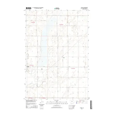
2015 Map of Putney
USGS Topo · Published 2015About this map
The James River snakes along the western edge of this Brown County landscape, defining a wetland-rich region characterized by significant water management features. At the heart of the terrain lies Putney Slough, a sprawling low-lying area fed by the Crow Cr Drainage Ditch, reflecting the agricultural drainage history of this part of the James River Valley. The small settlement of Putney sits along Putney Rd, serving as a focal point in a high-density grid of section roads including 127th St and 402nd Ave. To the west, the community of Tacoma Park is positioned near the river banks, accessed by the distinctive Tacoma Loop. This 2015 survey illustrates the enduring township and range system, showing the organized division of land into sections like t124n r61w, which has historically supported the region's grain farming economy.
Find a feature on this map
30 named features on this map. Tap any name to fly to it.
Don’t see what you’re looking for? This feature index may not catch every label — zoom into the map to look around manually.
Map Details
Editions of this 2015 Putney Map
This is the sole edition of this map. No revisions or reprints were ever made.
Other maps of this area

1894 · Columbia
USGS Topo · 1:62,500

1895 · Aberdeen
USGS Topo · 1:125,000

1896 · Columbia
USGS Topo · 1:125,000

1952 · Huffton
USGS Topo · 1:24,000

1952 · Columbia
USGS Topo · 1:24,000

1952 · Columbia NE
USGS Topo · 1:24,000

1952 · Putney
USGS Topo · 1:24,000

1954 · Bath
USGS Topo · 1:24,000

1954 · Groton
USGS Topo · 1:24,000

1954 · James
USGS Topo · 1:24,000