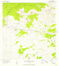
1956 Map of Puu Oo
USGS Topo · Published 1957About this map
Humuula Sheep Station and Puu Oo Ranch stand as isolated outposts of human habitation in this high-altitude landscape between the volcanic giants of Mauna Kea and Mauna Loa. The terrain is a complex record of geological events, marked by a series of significant historical events including the Lava Flow of 1843, Lava Flow of 1855, and the Lava Flow of 1935. These flows cut across the Saddle, influencing the path of the Saddle Road and the various jeep trails that navigate the rocky territory.
Find a feature on this map
37 named features on this map. Tap any name to fly to it.
Don’t see what you’re looking for? This feature index may not catch every label — zoom into the map to look around manually.
Map Details
Editions of this 1956 Puu Oo Map
2 editions found
Other maps of this area

1927 · Kaohe
USGS Topo · 1:62,500

1930 · Humuula
USGS Topo · 1:62,500

1930 · Kaohe
USGS Topo · 1:62,500

1954 · Hawaii North
USGS Topo · 1:250,000

1956 · Puu Oo
USGS Topo · 1:24,000

1956 · Pua Akala
USGS Topo · 1:24,000

1956 · Puu Koli
USGS Topo · 1:24,000

1956 · Upper Piihonua
USGS Topo · 1:24,000
1956 · Puu Ulaula
USGS Topo · 1:24,000
1956 · Kulani
USGS Topo · 1:24,000