
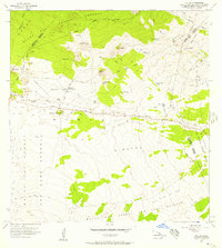
1956 Map of Puu Oo
USGS Topo · Published 1956About this map
Volcanic activity dominates this mid-century survey of the high-altitude landscape between Mauna Kea and the northern reaches of the Mauna Loa Game Reserve. The terrain is defined by successive volcanic events, including the sprawling Lava Flow of 1935 and earlier movements from the Lava Flow of 1843 and Lava Flow of 1855. Human presence in this environment is centered on the Humuula Sheep Station and Puu Oo Ranch, connected by the vital Saddle Road that cuts through the Humuula Saddle. These ranching outposts, along with the cluster of buildings at Omaokoili, provide a rare look at mid-century upland agriculture. The map also records numerous cinder cones like Puu Huluhulu and Puu Kahiliku, providing essential detail for researchers of Big Island geology and local ranching history.
Find a feature on this map
35 named features on this map. Tap any name to fly to it.
Don’t see what you’re looking for? This feature index may not catch every label — zoom into the map to look around manually.
Map Details
Editions of this 1956 Puu Oo Map
2 editions found
Other maps of this area

1927 · Kaohe
USGS Topo · 1:62,500

1930 · Humuula
USGS Topo · 1:62,500

1930 · Kaohe
USGS Topo · 1:62,500

1954 · Hawaii North
USGS Topo · 1:250,000

1956 · Pua Akala
USGS Topo · 1:24,000

1956 · Puu Koli
USGS Topo · 1:24,000

1956 · Upper Piihonua
USGS Topo · 1:24,000
1956 · Puu Ulaula
USGS Topo · 1:24,000
1956 · Kulani
USGS Topo · 1:24,000
1956 · Ahumoa
USGS Topo · 1:24,000