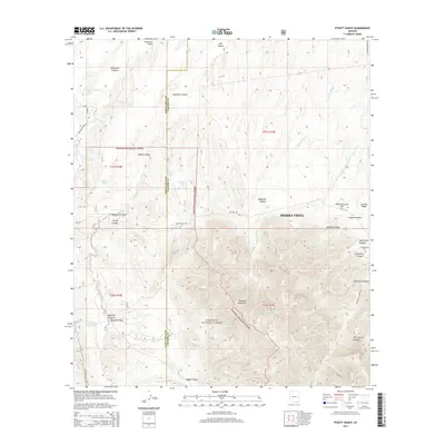
2014 Map of Pyeatt Ranch
USGS Topo · Published 2014About this map
Pyeatt Ranch and the eastern slopes of the Huachuca Mountains define this section of the Arizona borderlands. This 2014 survey captures the interface between the expanding outskirts of Sierra Vista and the protected wilderness of the Coronado National Forest. The landscape is dominated by a complex network of seasonal drainages, including Blacktail Wash and Slaughter House Wash, which cut through ridges like Laundry Ridge and Marshall Ridge.
Find a feature on this map
49 named features on this map. Tap any name to fly to it.
Don’t see what you’re looking for? This feature index may not catch every label — zoom into the map to look around manually.
Map Details
Editions of this 2014 Pyeatt Ranch Map
This is the sole edition of this map. No revisions or reprints were ever made.
Other maps of this area

1904 · Patagonia
USGS Topo · 1:125,000

1905 · Patagonia
USGS Topo · 1:125,000

1905 · Nogales
USGS Topo · 1:125,000

1914 · Hereford
USGS Topo · 1:125,000

1915 · Benson
USGS Topo · 1:125,000

1922 · Sunnyside
USGS Topo · 1:62,500

1932 · Lochiel
USGS Topo · 1:62,500

1932 · Elgin
USGS Topo · 1:62,500

1938 · Huachuca
USGS Topo · 1:62,500

1938 · Sunnyside
USGS Topo · 1:62,500