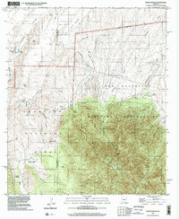
1996 Map of Pyeatt Ranch
USGS Topo · Published 2002About this map
Pyeatt Ranch sits at the intersection of private cattle ranching, federal forest land, and military infrastructure in this late-twentieth-century study of the Arizona borderlands. The landscape is defined by the sharp division between the Coronado National Forest and the Fort Huachuca Military Reservation, where the high peaks of the Huachuca Mountains give way to a network of drainage systems like O'Donnell Canyon and Blacktail Canyon.
Find a feature on this map
49 named features on this map. Tap any name to fly to it.
Don’t see what you’re looking for? This feature index may not catch every label — zoom into the map to look around manually.
Map Details
Editions of this 1996 Pyeatt Ranch Map
This is the sole edition of this map. No revisions or reprints were ever made.
Other maps of this area

1904 · Patagonia
USGS Topo · 1:125,000

1905 · Patagonia
USGS Topo · 1:125,000

1905 · Nogales
USGS Topo · 1:125,000

1914 · Hereford
USGS Topo · 1:125,000

1915 · Benson
USGS Topo · 1:125,000

1922 · Sunnyside
USGS Topo · 1:62,500

1932 · Lochiel
USGS Topo · 1:62,500

1932 · Elgin
USGS Topo · 1:62,500

1938 · Huachuca
USGS Topo · 1:62,500

1938 · Sunnyside
USGS Topo · 1:62,500