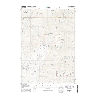
2013 Map of Pyle Creek
USGS Topo · Published 2013About this map
The Middle Fork Payette River carves through the heart of the Boise National Forest, defining a landscape of deep drainage and high ridge lines in central Idaho. This 2013 survey reveals a mountain corridor where recreational development and ranching heritage meet, notably at the Terrace Lakes Resort and the Hardscrabble Pasture located further north near the county line. The map highlights numerous geothermal features, such as Warm Springs and Hot Springs, which have long drawn interest to this section of the North Fork Range. Evidence of the area's timber and transport history is visible in the network of forest roads and named drainages like Auglebright Gulch and Powderhouse Gulch. From the heights of Bear Wallow Point to the riverside campsites at Tie Creek Campground, the map documents a transition between active forest management and established seasonal retreats.
Find a feature on this map
62 named features on this map. Tap any name to fly to it.
Don’t see what you’re looking for? This feature index may not catch every label — zoom into the map to look around manually.
Map Details
Editions of this 2013 Pyle Creek Map
This is the sole edition of this map. No revisions or reprints were ever made.
Other maps of this area

1894 · Squaw Creek
USGS Topo · 1:125,000

1909 · Garden Valley
USGS Topo · 1:125,000

1953 · Smiths Ferry
USGS Topo · 1:62,500

1953 · Boiling Springs
USGS Topo · 1:62,500

1953 · Banks
USGS Topo · 1:62,500

1955 · Baker
USGS Topo · 1:250,000

1957 · Challis
USGS Topo · 1:250,000

1959 · Baker
USGS Topo · 1:250,000

1959 · Garden Valley
USGS Topo · 1:62,500

1960 · Challis
USGS Topo · 1:250,000