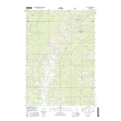
2017 Map of Pyle Creek
USGS Topo · Published 2017About this map
The Middle Fork Payette River carves a deep path through the Boise National Forest in this 2017 study of the high country north of the Boise River basin. The landscape is defined by its drainage systems, from the North Fork Range in the west to the prominent Lightning Ridge in the east. Local history and recreation are centered around water features like Hot Springs and Warm Springs Cr, while the network of forest service and local roads, including Scriver Creek Rd and S Middle Fork Rd, provides access to the high-elevation points of Bear Wallow Point and Pyle Creek Point. This map captures a modern snapshot of a working forest landscape, showing the many spurs and loops used for timber management and access to landmarks like Hardscrabble Pasture.
Find a feature on this map
88 named features on this map. Tap any name to fly to it.
Don’t see what you’re looking for? This feature index may not catch every label — zoom into the map to look around manually.
Map Details
Editions of this 2017 Pyle Creek Map
This is the sole edition of this map. No revisions or reprints were ever made.
Other maps of this area

1894 · Squaw Creek
USGS Topo · 1:125,000

1909 · Garden Valley
USGS Topo · 1:125,000

1953 · Smiths Ferry
USGS Topo · 1:62,500

1953 · Boiling Springs
USGS Topo · 1:62,500

1953 · Banks
USGS Topo · 1:62,500

1955 · Baker
USGS Topo · 1:250,000

1957 · Challis
USGS Topo · 1:250,000

1959 · Baker
USGS Topo · 1:250,000

1959 · Garden Valley
USGS Topo · 1:62,500

1960 · Challis
USGS Topo · 1:250,000