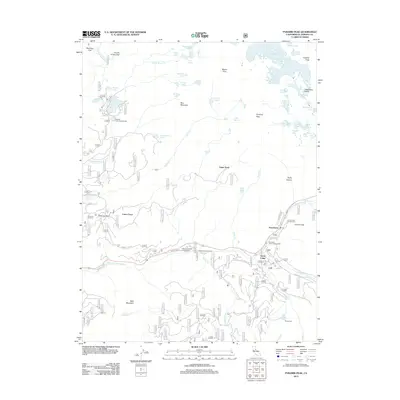
2012 Map of Pyramid Peak
USGS Topo · Published 2012About this map
Strawberry and Sciots Camp serve as the primary human hubs in this alpine landscape of the Sierra Nevada, situated along a transportation corridor marked by historic milestones like 39 Mile Stone and 42 Mile Stone. The area is defined by its transition from organized recreation at Wrights Lake Campground and Lovers Leap Campground to the high-elevation wilderness of Desolation Valley.
Find a feature on this map
65 named features on this map. Tap any name to fly to it.
Don’t see what you’re looking for? This feature index may not catch every label — zoom into the map to look around manually.
Map Details
Editions of this 2012 Pyramid Peak Map
This is the sole edition of this map. No revisions or reprints were ever made.
Other maps of this area

1889 · Pyramid Peak
USGS Topo · 1:125,000

1891 · Pyramid Peak
USGS Topo · 1:125,000

1895 · Pyramid Peak
USGS Topo · 1:125,000

1896 · Pyramid Peak
USGS Topo · 1:125,000

1947 · Sacramento
USGS Topo · 1:250,000

1948 · Sacramento
USGS Topo · 1:250,000

1951 · Leek Spring Hill
USGS Topo · 1:24,000
1951 · Leek Spring Hill
USGS Topo · 1:62,500
1952 · Kyburz
USGS Topo · 1:24,000
1952 · Loon Lake
USGS Topo · 1:24,000