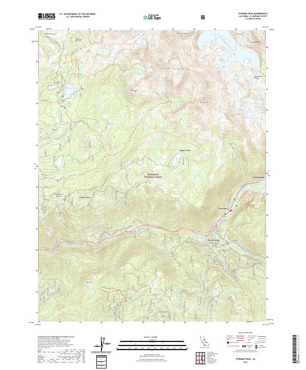
2021 Map of Pyramid Peak
USGS Topo · Published 2021About this map
The Crystal Range and Pyramid Peak dominate the topography of the Eldorado National Forest, where high-elevation granite basins are filled with an intricate network of glacial lakes including Lake Aloha, Channel Lake, and Wrights Lake. This landscape, while primarily defined by its elevation and the Desolation Valley, contains traces of historical movement through the Sierra Nevada. The Pony Express Trl and the modern El Dorado Fwy parallel the S Fork American River, anchoring the small mountain settlements of Strawberry and Sciots Camp. Historic landmarks like the 39 Mile Stone and 42 Mile Stone mark the corridor's long-standing role as a vital passage. Forni family history is visible in the placement of Upper Forni and Lower Forni, suggesting seasonal land use in the high meadows before the region became a protected wilderness destination.
Find a feature on this map
96 named features on this map. Tap any name to fly to it.
Don’t see what you’re looking for? This feature index may not catch every label — zoom into the map to look around manually.
Map Details
Editions of this 2021 Pyramid Peak Map
This is the sole edition of this map. No revisions or reprints were ever made.
Other maps of this area

1889 · Pyramid Peak
USGS Topo · 1:125,000

1891 · Pyramid Peak
USGS Topo · 1:125,000

1895 · Pyramid Peak
USGS Topo · 1:125,000

1896 · Pyramid Peak
USGS Topo · 1:125,000

1947 · Sacramento
USGS Topo · 1:250,000

1948 · Sacramento
USGS Topo · 1:250,000

1951 · Leek Spring Hill
USGS Topo · 1:24,000
1951 · Leek Spring Hill
USGS Topo · 1:62,500
1952 · Kyburz
USGS Topo · 1:24,000
1952 · Loon Lake
USGS Topo · 1:24,000