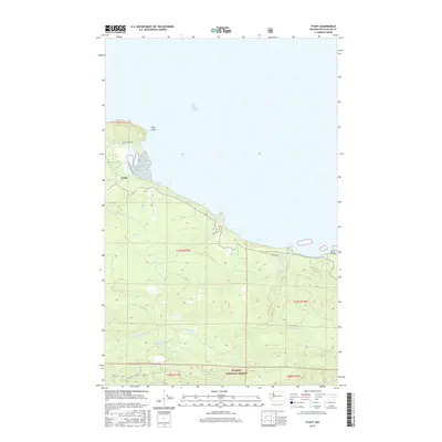
2017 Map of Pysht
USGS Topo · Published 2017About this map
The coastal settlement of Pysht sits at the junction of the Pysht River and the Strait of Juan de Fuca, characterizing a landscape defined by the intersection of the maritime economy and the timber-rich hills of the Olympic Peninsula. The shoreline is punctuated by prominent navigational landmarks like Pillar Point and Tree Bluff, while the inland terrain climbs into the northern reaches of the Olympic National Forest. Historical industry is evidenced by the Pysht Millpond located south of the main townsite, where the S Fork Pysht River and several tributaries such as Butler Cr and Indian Cr drain the steep, forested slopes. This 2017 survey reflects the modern road network, including Pysht River Rd and Gibson Rd, which provide access to the various forks of Deep Cr in the eastern portion of the quadrangle.
Find a feature on this map
24 named features on this map. Tap any name to fly to it.
Don’t see what you’re looking for? This feature index may not catch every label — zoom into the map to look around manually.
Map Details
Editions of this 2017 Pysht Map
This is the sole edition of this map. No revisions or reprints were ever made.
Other maps of this area

1918 · Lake Crescent
USGS Topo · 1:62,500

1922 · Pysht
USGS Topo · 1:62,500

1922 · Lake Crescent
USGS Topo · 1:62,500

1942 · Pysht
USGS Topo · 1:62,500

1950 · Mount Muller
USGS Topo · 1:24,000

1950 · Twin Rivers
USGS Topo · 1:24,000
1950 · Lake Crescent
USGS Topo · 1:62,500

1953 · Cape Flattery
USGS Topo · 1:250,000
1957 · Pysht
USGS Topo · 1:62,500

1957 · Victoria
USGS Topo · 1:250,000