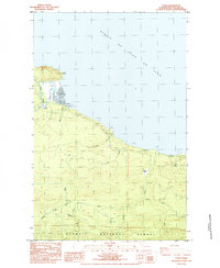
1984 Map of Pysht
USGS Topo · Published 1984About this map
Pillar Point stands as a prominent landmark along the southern coast of the Strait of Juan de Fuca, marking the entrance to Butler Cove. This mid-1980s provisional survey illustrates a landscape defined by the drainage networks of the Pysht River and its various tributaries, including the West Fork Pysht River and South Fork Pysht River. The settlement of Pysht and the nearby Pysht Millpond point to the area's timber and milling heritage, while the southern reaches of the map transition into the protected lands of the Olympic National Forest. Smaller family-named locations like Gibson Farm and localized features such as Beaver Ponds along Deep Creek provide a granular look at the rural character of the Clallam County coast during this era.
Find a feature on this map
25 named features on this map. Tap any name to fly to it.
Don’t see what you’re looking for? This feature index may not catch every label — zoom into the map to look around manually.
Map Details
Editions of this 1984 Pysht Map
This is the sole edition of this map. No revisions or reprints were ever made.
Other maps of this area

1918 · Lake Crescent
USGS Topo · 1:62,500

1922 · Pysht
USGS Topo · 1:62,500

1922 · Lake Crescent
USGS Topo · 1:62,500

1942 · Pysht
USGS Topo · 1:62,500

1950 · Mount Muller
USGS Topo · 1:24,000

1950 · Twin Rivers
USGS Topo · 1:24,000
1950 · Lake Crescent
USGS Topo · 1:62,500

1953 · Cape Flattery
USGS Topo · 1:250,000
1957 · Pysht
USGS Topo · 1:62,500

1957 · Victoria
USGS Topo · 1:250,000