
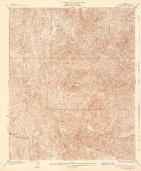
1933 Map of Quail
USGS Topo · Published 1933About this map
Quail Lake sits at the center of this mountain pass landscape, serving as a landmark along the critical transport corridor between the Central Valley and Southern California. During the early 1930s, this area was defined by the transition from the old Ridge Route to the developing U. S. Highway No 99, reflecting a significant era of automotive infrastructure expansion. The map identifies the Quail Lake School and Bailey Ranch near the water's edge, while the southern peaks are anchored by the U. S. Weather Bureau Station and remote stops like Sandberg and Tumble Inn.
Find a feature on this map
16 named features on this map. Tap any name to fly to it.
Don’t see what you’re looking for? This feature index may not catch every label — zoom into the map to look around manually.
Map Details
Editions of this 1933 Quail Map
This is the sole edition of this map. No revisions or reprints were ever made.
Other maps of this area

1903 · Tejon
USGS Topo · 1:125,000

1931 · Redrock Mtn
USGS Topo · 1:24,000

1932 · Beartrap Canyon
USGS Topo · 1:24,000

1932 · Neenach
USGS Topo · 1:24,000

1933 · Gorman
USGS Topo · 1:24,000
1936 · Redrock Mtn.
USGS Topo · 1:24,000

1938 · Beartrap Canyon
USGS Topo · 1:24,000

1938 · Gorman
USGS Topo · 1:24,000

1938 · Liebre
USGS Topo · 1:24,000

1938 · Black Mountain
USGS Topo · 1:24,000