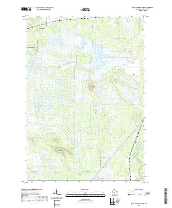
2022 Map of Quail Point Flowage
USGS Topo · Published 2022About this map
The drainage network of central Wisconsin's Wood County is defined here by the confluence of major hydraulic systems and glacial landforms. The Quail Point Flowage and South Gallagher Flowage dominate the central landscape, part of a complex wetland and flowage system that includes the East Potts Flowage. These water bodies are flanked by the distinct elevations of North Bluff and South Bluff, providing rare vertical relief in an otherwise low-lying area. The hydrological story is one of transition, where the East Fork Black River clips the northwest corner while the Little Yellow River and Yellow River drain the southern reaches. Human modification of the landscape is evident through the Remington Ditch, a significant channel designed to manage the high water table of the surrounding marshlands. The road network, including Kurt Creek Rd and Stout Marsh Rd, follows the section lines, navigating between the extensive flowages and creek beds of Turner Creek and Kurt Cr.
Find a feature on this map
32 named features on this map. Tap any name to fly to it.
Don’t see what you’re looking for? This feature index may not catch every label — zoom into the map to look around manually.
Map Details
Editions of this 2022 Quail Point Flowage Map
This is the sole edition of this map. No revisions or reprints were ever made.
Other maps of this area

1953 · Eau Claire
USGS Topo · 1:250,000

1957 · Pittsville
USGS Topo · 1:48,000

1957 · City Point
USGS Topo · 1:48,000

1958 · Eau Claire
USGS Topo · 1:250,000

1958 · Necedah
USGS Topo · 1:48,000

1958 · Wyeville
USGS Topo · 1:48,000

1964 · Eau Claire
USGS Topo · 1:250,000

1967 · Pittsville
USGS Topo · 1:62,500
1969 · New Miner
USGS Topo · 1:24,000
1969 · Finley
USGS Topo · 1:24,000