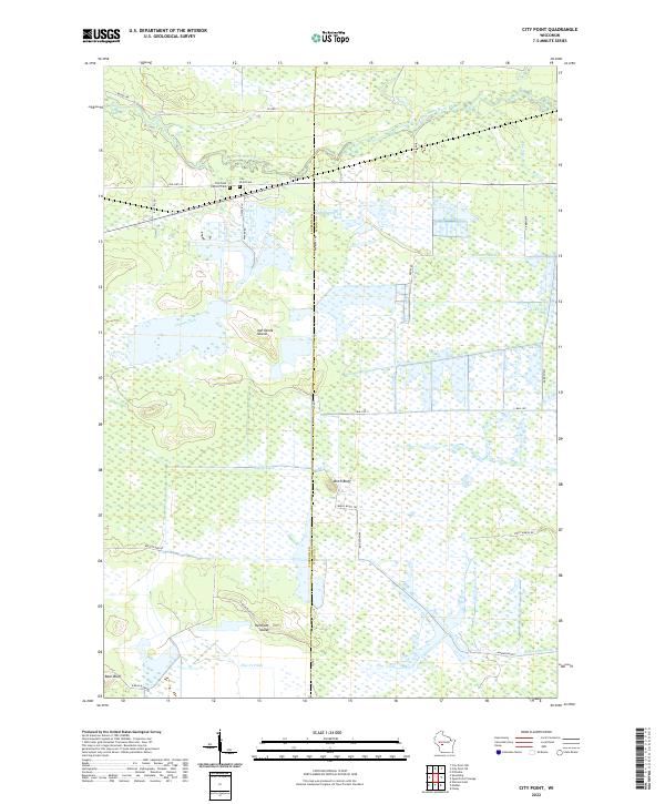
2022 Map of City Point
USGS Topo · Published 2022About this map
The settlement of City Point serves as the focal point for this landscape where central Wisconsin's marshlands meet the East Fork Black River. Defined by an intricate network of drainage systems like Weisner Ditch, Bissig Ditch, and Remington Ditch, the area illustrates a long history of water management to support local land use across the Jackson and Wood County line. Several distinct landforms rise above the surrounding wetlands, including Birch Bluff, Bear Bluff, and the oddly named Ketchum Island. Genealogists will find interest in the proximity of the City Point Cemetery and City Point Catholic Cemetery, both situated near the riverbanks. The local infrastructure, characterized by roads like Birch Bluff Trail and Stout Marsh Road, suggests a terrain shaped by logging or cranberry cultivation, while the varied hydrography of Indian Creek and Hay Creek underscores the region's complex riparian environment.
Find a feature on this map
40 named features on this map. Tap any name to fly to it.
Don’t see what you’re looking for? This feature index may not catch every label — zoom into the map to look around manually.
Map Details
Editions of this 2022 City Point Map
This is the sole edition of this map. No revisions or reprints were ever made.
Other maps of this area

1953 · Eau Claire
USGS Topo · 1:250,000

1957 · Pittsville
USGS Topo · 1:48,000

1957 · City Point
USGS Topo · 1:48,000

1958 · Eau Claire
USGS Topo · 1:250,000

1958 · Necedah
USGS Topo · 1:48,000

1958 · Wyeville
USGS Topo · 1:48,000

1964 · Eau Claire
USGS Topo · 1:250,000

1967 · Pittsville
USGS Topo · 1:62,500
1969 · Finley
USGS Topo · 1:24,000

1970 · City Point NE
USGS Topo · 1:24,000