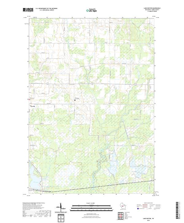
2022 Map of Lake Dexter
USGS Topo · Published 2022About this map
Pittsville and the crossroads at Dexterville anchor this portion of Wood County, where the landscape is defined by the intricate drainages of the Hemlock Creek watershed. The area is marked by a transition from the structured street grid of Pittsville to the extensive wetlands and winding tributaries that feed into Lake Dexter. Historically significant landmarks like Saint Johns Lutheran Cem are positioned along a network of rural routes such as Lincoln Rd and Co Hwy E. The hydrologic patterns of Owl Creek and Little Hemlock Cr illustrate the low-lying, water-rich character of this central Wisconsin terrain, which has long influenced local land use and settlement patterns between the forest and the farm.
Find a feature on this map
48 named features on this map. Tap any name to fly to it.
Don’t see what you’re looking for? This feature index may not catch every label — zoom into the map to look around manually.
Map Details
Editions of this 2022 Lake Dexter Map
This is the sole edition of this map. No revisions or reprints were ever made.
Other maps of this area

1953 · Eau Claire
USGS Topo · 1:250,000

1954 · Marshfield
USGS Topo · 1:62,500

1955 · Green Bay
USGS Topo · 1:250,000

1956 · Milladore
USGS Topo · 1:48,000

1957 · Wisconsin Rapids
USGS Topo · 1:48,000

1957 · Pittsville
USGS Topo · 1:48,000

1958 · Eau Claire
USGS Topo · 1:250,000

1964 · Eau Claire
USGS Topo · 1:250,000

1967 · Wisconsin Rapids
USGS Topo · 1:62,500

1967 · Pittsville
USGS Topo · 1:62,500