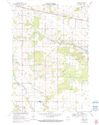
1970 Map of Sherry
USGS Topo · Published 1990About this map
Agricultural lands and intersecting rail lines define this Central Wisconsin landscape during the 1970s. The village of Auburndale anchors the northwestern corner, while the small settlements of Sherry and Blenker (Sherry Sta) serve as local hubs for the surrounding farming community. The area is crisscrossed by two major rail routes: the Soo Line running east-west through the northern section and the Chicago and North Western cutting through the southwest.
Find a feature on this map
23 named features on this map. Tap any name to fly to it.
Don’t see what you’re looking for? This feature index may not catch every label — zoom into the map to look around manually.
Map Details
Editions of this 1970 Sherry Map
2 editions found
Other maps of this area

1953 · Eau Claire
USGS Topo · 1:250,000

1954 · Marshfield
USGS Topo · 1:62,500

1955 · Green Bay
USGS Topo · 1:250,000

1956 · Milladore
USGS Topo · 1:48,000

1957 · Wisconsin Rapids
USGS Topo · 1:48,000

1957 · Pittsville
USGS Topo · 1:48,000

1958 · Eau Claire
USGS Topo · 1:250,000

1964 · Eau Claire
USGS Topo · 1:250,000

1967 · Wisconsin Rapids
USGS Topo · 1:62,500

1967 · Pittsville
USGS Topo · 1:62,500