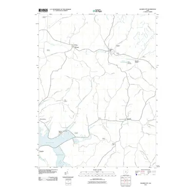
2010 Map of Quaker City
USGS Topo · Published 2010About this map
Quaker City and its surrounding hill country define this southeastern Ohio landscape, where established small towns are linked by winding valley roads. The area is marked by a deep genealogical footprint, evidenced by numerous small burial grounds such as Friends Cemetery, Saint Johns Cemetery, and Wyscarver Cemetery that dot the ridges and hollows. In the north, Salesville sits along Leatherwood Creek, while the southern reaches are dominated by the waters of Senecaville Lake and the settlement of Lakeland.
Find a feature on this map
80 named features on this map. Tap any name to fly to it.
Don’t see what you’re looking for? This feature index may not catch every label — zoom into the map to look around manually.
Map Details
Editions of this 2010 Quaker City Map
This is the sole edition of this map. No revisions or reprints were ever made.
Other maps of this area

1903 · Flushing
USGS Topo · 1:62,500

1905 · Woodsfield
USGS Topo · 1:62,500

1905 · Flushing
USGS Topo · 1:62,500

1909 · Antrim
USGS Topo · 1:48,000

1909 · Summerfield
USGS Topo · 1:62,500

1911 · Antrim
USGS Topo · 1:62,500

1911 · Summerfield
USGS Topo · 1:62,500

1949 · Clarksburg
USGS Topo · 1:250,000

1951 · Canton
USGS Topo · 1:250,000

1953 · Canton
USGS Topo · 1:250,000