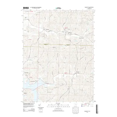
2013 Map of Quaker City
USGS Topo · Published 2013About this map
Quaker City and Batesville anchor this corner of the Appalachian Plateau, where the border of Guernsey and Noble Counties runs through a landscape defined by deeply carved stream valleys. The network of waterways, including Leatherwood Creek and Beaver Creek, historically dictated the placement of early settlements and rural cemeteries. Genealogists will find a high density of burial sites such as Friends Cem, Palestine Cem, and Wyscarver Cem, often located on high ground above the valley floors. In the southwest, the waters of Senecaville Lake illustrate the 20th-century management of the watershed, while the name B & O Railroad Pond near Spencer Station remains as a marker of the rail infrastructure that once linked these communities. The map also captures several smaller residential areas like Sue-Lin Acres and Lakeland, reflecting more recent land development patterns.
Find a feature on this map
127 named features on this map. Tap any name to fly to it.
Don’t see what you’re looking for? This feature index may not catch every label — zoom into the map to look around manually.
Map Details
Editions of this 2013 Quaker City Map
This is the sole edition of this map. No revisions or reprints were ever made.
Other maps of this area

1903 · Flushing
USGS Topo · 1:62,500

1905 · Woodsfield
USGS Topo · 1:62,500

1905 · Flushing
USGS Topo · 1:62,500

1909 · Antrim
USGS Topo · 1:48,000

1909 · Summerfield
USGS Topo · 1:62,500

1911 · Antrim
USGS Topo · 1:62,500

1911 · Summerfield
USGS Topo · 1:62,500

1949 · Clarksburg
USGS Topo · 1:250,000

1951 · Canton
USGS Topo · 1:250,000

1953 · Canton
USGS Topo · 1:250,000