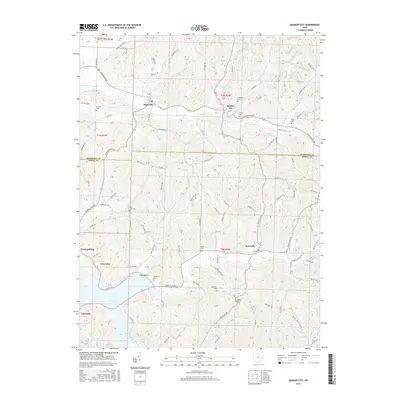
2016 Map of Quaker City
USGS Topo · Published 2016About this map
Quaker City and Salesville anchor this corner of the Ohio countryside where Leatherwood Cr winds through the hills of Guernsey and Noble Counties. The landscape is defined by its rural heritage, with numerous family and community burial grounds such as Greenlawn Cem, Sandhill Cem, and Palestine Cem marking the locations of early area congregations and homesteads. Further south, the terrain descends toward the waters of Senecaville Lake, where the community of Lakeland sits near the shoreline. The intricate network of township and county roads follows the older topography of Yoker Valley and the drainages of Beaver Cr, connecting isolated settlements like Batesville and Kennonsburg. A distinctive industrial landmark, the B & O Railroad Pond, remains as a reminder of the rail infrastructure that once served this region's small-town economies.
Find a feature on this map
131 named features on this map. Tap any name to fly to it.
Don’t see what you’re looking for? This feature index may not catch every label — zoom into the map to look around manually.
Map Details
Editions of this 2016 Quaker City Map
This is the sole edition of this map. No revisions or reprints were ever made.
Other maps of this area

1903 · Flushing
USGS Topo · 1:62,500

1905 · Woodsfield
USGS Topo · 1:62,500

1905 · Flushing
USGS Topo · 1:62,500

1909 · Antrim
USGS Topo · 1:48,000

1909 · Summerfield
USGS Topo · 1:62,500

1911 · Antrim
USGS Topo · 1:62,500

1911 · Summerfield
USGS Topo · 1:62,500

1949 · Clarksburg
USGS Topo · 1:250,000

1951 · Canton
USGS Topo · 1:250,000

1953 · Canton
USGS Topo · 1:250,000