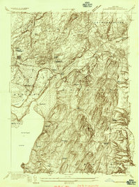
1934 Map of Quaker Springs
USGS Topo · Published 1934About this map
The eastern shores of Saratoga Lake and the rolling uplands of Saratoga and Stillwater are documented in this 1934 survey, which highlights the area's transition from recreational lakeside landscapes to fertile agricultural hills. The map is anchored by the historic Saratoga Battlefield in the southeast, while the northern sections show a dense network of local schools and named crossroads such as Deans Corners and Quaker Springs. Transportation is defined by the heavy infrastructure of the Boston and Maine Railroad and the Delaware and Hudson RR, which skirt the swamps and bluffs along Fish Creek. Genealogists will find significant detail in the multiple rural burial grounds, including Louden Cem and the Jewish Community Center Cem, as well as the numerous family-named landmarks like Ketchums Corners and Snake Hill.
Find a feature on this map
48 named features on this map. Tap any name to fly to it.
Don’t see what you’re looking for? This feature index may not catch every label — zoom into the map to look around manually.
Map Details
Editions of this 1934 Quaker Springs Map
This is the sole edition of this map. No revisions or reprints were ever made.
Other maps of this area

1893 · Cohoes
USGS Topo · 1:62,500

1893 · Schenectady
USGS Topo · 1:62,500

1895 · Cohoes
USGS Topo · 1:62,500

1895 · Schenectady
USGS Topo · 1:62,500

1898 · Schenectady
USGS Topo · 1:62,500

1898 · Cohoes
USGS Topo · 1:62,500

1900 · Schuylerville
USGS Topo · 1:62,500

1902 · Saratoga
USGS Topo · 1:62,500

1929 · Cohoes
USGS Topo · 1:62,500

1930 · Schenectady
USGS Topo · 1:62,500