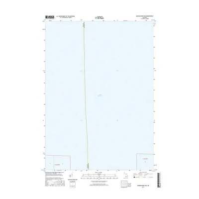
2017 Map of Quanicassee OE N
USGS Topo · Published 2017About this map
Lake Huron dominates this 2017 survey, which covers a significant portion of the water within the Saginaw Bay region. The map illustrates the aquatic boundary where the jurisdictional lines of Bay Co and Tuscola Co meet beneath the surface. This specific quadrangle captures a moment in the modern era of the Great Lakes' nautical geography, showing very little terrestrial land save for small sections of coastal township divisions in the south. These include portions of t14n r6e and t14n r7e, marking the transition from the agricultural interior of the thumb region into the open water of the bay.
Find a feature on this map
6 named features on this map. Tap any name to fly to it.
Don’t see what you’re looking for? This feature index may not catch every label — zoom into the map to look around manually.
Map Details
Editions of this 2017 Quanicassee OE N Map
This is the sole edition of this map. No revisions or reprints were ever made.
Other maps of this area

1916 · Bay City
USGS Topo · 1:62,500

1919 · Bay City
USGS Topo · 1:62,500

1943 · Bay City
USGS Topo · 1:62,500

1954 · Flint
USGS Topo · 1:250,000

1958 · Flint
USGS Topo · 1:250,000

1963 · Quanicassee
USGS Topo · 1:24,000

1963 · Fish Point
USGS Topo · 1:24,000

1963 · Fairgrove
USGS Topo · 1:24,000
1967 · Essexville
USGS Topo · 1:24,000
1967 · Bay City NE
USGS Topo · 1:24,000