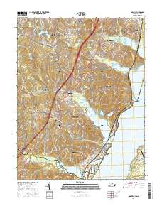
2016 Map of Quantico
USGS Topo · Published 2016About this map
MCB Quantico and the Quantico Marine Corps Air Field / Turner Field dominate the southern shoreline of this Potomac River landscape, illustrating the deep military heritage of Prince William County. The map details the transition from high-speed transit corridors like Interstate 95 and USMC Truck Hwy to the preserved woodlands of Prince William Forest Park. Local genealogy and settlement history are preserved through several documented burial sites, including Neabsco Cem and Hardens Hill Cem, alongside long-standing communities such as Dumfries and Triangle. The intricate coastline is defined by features like Chopawamsic Creek and Possum Point, where the land meets the Potomac River at the Maryland state line. This record provides a clear look at suburban development in Dale City and Montclair as they stood in the mid-2010s.
Find a feature on this map
62 named features on this map. Tap any name to fly to it.
Don’t see what you’re looking for? This feature index may not catch every label — zoom into the map to look around manually.
Map Details
Editions of this 2016 Quantico Map
This is the sole edition of this map. No revisions or reprints were ever made.
Other maps of this area

1889 · Fredericksburg
USGS Topo · 1:125,000

1890 · Mt. Vernon
USGS Topo · 1:125,000

1891 · Mt. Vernon
USGS Topo · 1:125,000

1892 · Fredericksburg
USGS Topo · 1:125,000

1894 · Fredericksburg
USGS Topo · 1:125,000

1894 · Mt. Vernon
USGS Topo · 1:125,000

1897 · Mt. Vernon
USGS Topo · 1:125,000

1913 · Indian Head
USGS Topo · 1:62,500

1913 · Nanjemoy
USGS Topo · 1:62,500

1923 · Indian Head
USGS Topo · 1:48,000