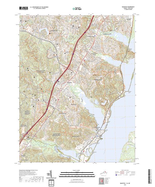
2022 Map of Quantico
USGS Topo · Published 2022About this map
The Marine Corps Base Quantico landscape dominates this coastal Virginia region, where military operations meet preserved natural spaces. The topography is defined by the sharp transition from the tidal Potomac River and Goose Bay to the densely wooded interiors of Prince William Forest Park. This area serves as a critical corridor for both history and modern transit, featuring the historic town of Dumfries and the expansive Quantico National Cemetery.
Find a feature on this map
85 named features on this map. Tap any name to fly to it.
Don’t see what you’re looking for? This feature index may not catch every label — zoom into the map to look around manually.
Map Details
Editions of this 2022 Quantico Map
This is the sole edition of this map. No revisions or reprints were ever made.
Other maps of this area

1889 · Fredericksburg
USGS Topo · 1:125,000

1890 · Mt. Vernon
USGS Topo · 1:125,000

1891 · Mt. Vernon
USGS Topo · 1:125,000

1892 · Fredericksburg
USGS Topo · 1:125,000

1894 · Fredericksburg
USGS Topo · 1:125,000

1894 · Mt. Vernon
USGS Topo · 1:125,000

1897 · Mt. Vernon
USGS Topo · 1:125,000

1913 · Indian Head
USGS Topo · 1:62,500

1913 · Nanjemoy
USGS Topo · 1:62,500

1923 · Indian Head
USGS Topo · 1:48,000