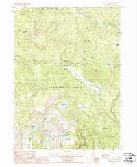
1988 Map of Quartz Valley
USGS Topo · Published 1988About this map
Fremont National Forest defines this high-elevation landscape in Lake County, where logging and mining operations shaped the rugged terrain. Industrial relics like the Old RR Grade and a Wooden Pole Trans Line slice through the timber, marking the infrastructure of the late 20th century. Near Quartz Mountain Pass, numerous prospects, a mineshaft, and Open Pit Mines indicate active mineral exploration. The map reveals a highly managed watershed with multiple artificial impoundments, including Butcher Flat Reservoir and Holbrook Reservoir. These sites, along with the Lofton Reservoir Campground and natural features like Petes Puddle and Tule Pond, suggest a region balanced between resource extraction and backcountry recreation during the 1980s. Local history is anchored at sites such as Round Grove and the historical Angel Camp (Site) near Drews Creek.
Find a feature on this map
46 named features on this map. Tap any name to fly to it.
Don’t see what you’re looking for? This feature index may not catch every label — zoom into the map to look around manually.
Map Details
Editions of this 1988 Quartz Valley Map
This is the sole edition of this map. No revisions or reprints were ever made.
Other maps of this area

1955 · Klamath Falls
USGS Topo · 1:250,000

1958 · Klamath Falls
USGS Topo · 1:250,000

1960 · Strawberry Butte
USGS Topo · 1:62,500

1960 · Fishhole Mtn
USGS Topo · 1:62,500

1964 · Drews Reservoir
USGS Topo · 1:24,000

1964 · Coleman Point
USGS Topo · 1:24,000

1964 · Cougar Peak
USGS Topo · 1:24,000

1975 · Lakeview
USGS Topo · 1:100,000
1988 · Arkansas Flat
USGS Topo · 1:24,000
1988 · Barnes Valley
USGS Topo · 1:24,000