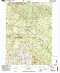
2004 Map of Quartz Valley
USGS Topo · Published 2007About this map
The Fremont National Forest dominates this landscape, defined by high-altitude volcanic topography and a sophisticated water management system that includes the Holbrook Reservoir, Lofton Reservoir, and Big Swamp Reservoir. The high elevations of Quartz Mountain and Fishhole Mountain overlook a terrain marked by early 21st-century resource extraction and forestry operations. This 2004 revision reveals the industrial history of the region through numerous prospects, a Mineshaft, and Open Pit Mines concentrated near the peaks. Evidence of past occupancy and seasonal operations appears at Angel Camp (Site) and Ewauna Camp, while the presence of Creed Field and its accompanying Landing Strip suggests the necessity of aerial access for fire management or logistics in this complex terrain of the Oregon Cascades.
Find a feature on this map
46 named features on this map. Tap any name to fly to it.
Don’t see what you’re looking for? This feature index may not catch every label — zoom into the map to look around manually.
Map Details
Editions of this 2004 Quartz Valley Map
This is the sole edition of this map. No revisions or reprints were ever made.
Other maps of this area

1955 · Klamath Falls
USGS Topo · 1:250,000

1958 · Klamath Falls
USGS Topo · 1:250,000

1960 · Strawberry Butte
USGS Topo · 1:62,500

1960 · Fishhole Mtn
USGS Topo · 1:62,500

1964 · Drews Reservoir
USGS Topo · 1:24,000

1964 · Coleman Point
USGS Topo · 1:24,000

1964 · Cougar Peak
USGS Topo · 1:24,000

1975 · Lakeview
USGS Topo · 1:100,000
1988 · Arkansas Flat
USGS Topo · 1:24,000
1988 · Barnes Valley
USGS Topo · 1:24,000