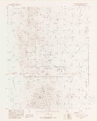
1988 Map of Quartzite Mountain
USGS Topo · Published 1988About this map
Quartzite Mountain and the Kawich Range dominate this high-desert landscape in Nye County, where mineral exploration and military use define the land. The presence of the Nellis Air Force Range (Restricted Area) and the Nevada Wild Horse Management Area illustrates the transition from traditional mining activity to large-scale federal land management in late 20th-century Nevada.
Find a feature on this map
21 named features on this map. Tap any name to fly to it.
Don’t see what you’re looking for? This feature index may not catch every label — zoom into the map to look around manually.
Map Details
Editions of this 1988 Quartzite Mountain Map
This is the sole edition of this map. No revisions or reprints were ever made.
Other maps of this area

1908 · Kawich
USGS Topo · 1:250,000

1942 · Reveille Peak
USGS Topo · 1:125,000

1942 · Wheelbarrow Peak
USGS Topo · 1:125,000

1952 · Quartzite Mtn
USGS Topo · 1:62,500

1952 · Wheelbarrow Peak
USGS Topo · 1:62,500

1952 · Silent Canyon
USGS Topo · 1:62,500

1952 · Belted Peak
USGS Topo · 1:62,500

1954 · Goldfield
USGS Topo · 1:250,000

1955 · Goldfield
USGS Topo · 1:250,000

1958 · Goldfield
USGS Topo · 1:250,000