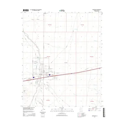
2014 Map of Quartzsite
USGS Topo · Published 2014About this map
Quartzsite serves as the central hub of this desert landscape, situated at the junction of major transit corridors that cross the La Posa Plain. The town's grid is characterized by descriptive street names like Ironwood St, Camel St, and Gold Nugget Rd, reflecting its identity as a waystation for travelers and prospectors. The terrain is defined by complex drainage networks, with the wide Plomosa Wash and Scaddan Wash carving through the arid flats, while Granite Mtn rises to the southwest. North of the main settlement, the land remains largely open, marked by landmarks such as Boyer Gap and the winding course of Italian Wash. This 2014 survey documents the modern layout of this desert community, including various trails like Sunrist Trl that lead away from the developed center into the surrounding Arizona backcountry.
Find a feature on this map
71 named features on this map. Tap any name to fly to it.
Don’t see what you’re looking for? This feature index may not catch every label — zoom into the map to look around manually.
Map Details
Editions of this 2014 Quartzsite Map
This is the sole edition of this map. No revisions or reprints were ever made.
Other maps of this area

1930 · Linskey
USGS Topo · 1:62,500

1931 · Moon Mtn
USGS Topo · 1:62,500

1932 · Moon Mtn
USGS Topo · 1:62,500

1933 · Cunningham Mtn
USGS Topo · 1:48,000

1940 · Dome Rock Mts
USGS Topo · 1:62,500

1942 · Blythe
USGS Topo · 1:250,000

1942 · MOON MTN
USGS Topo · 1:62,500

1954 · Salton Sea
USGS Topo · 1:250,000

1955 · Salton Sea
USGS Topo · 1:250,000

1959 · Salton Sea
USGS Topo · 1:250,000