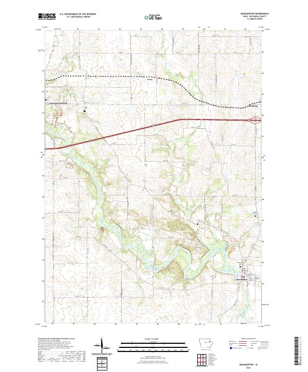
2022 Map of Quasqueton
USGS Topo · Published 2022About this map
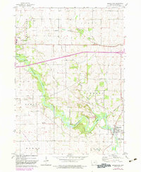
The Wapsipinicon River carves a winding path through this corner of Buchanan County, anchoring the settlement of Quasqueton. This landscape is defined by the intersection of river valley topography and the rigid grid of rural Iowa road networks like King Ave and 200th ST. To the north, the small hamlet of Doris and the larger town of Winthrop mark the transition toward the open agricultural uplands. The distribution of family and community landmarks, such as Wilson Cem, Pine Creek Cem, and Hickory Grove Cem, provides a map of early settlement patterns along the waterways and township lines. Water management and drainage are evident through features like Malone Cr and Dry Cr, which feed the larger river system. Near Quasqueton, the presence of Girl Scout Blvd suggests a long-standing tradition of riverfront recreation and community space in this eastern Iowa prairie region.
Find a feature on this map
65 named features on this map. Tap any name to fly to it.
Don’t see what you’re looking for? This feature index may not catch every label — zoom into the map to look around manually.
Map Details
Editions of this 2022 Quasqueton Map
This is the sole edition of this map. No revisions or reprints were ever made.