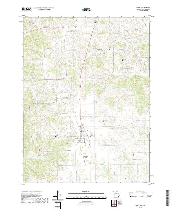
2021 Map of Queen City
USGS Topo · Published 2021About this map
Queen City serves as the primary hub for this Schuyler County landscape, positioned along the central transportation corridor where Highway 63 meets local routes like State Hwy O and State Hwy E. The surrounding terrain is defined by the complex drainage of the Fabius and Salt River systems, including the S Fork Middle Fabius River and the N Fork Salt River. This map is particularly valuable for genealogical research, documenting numerous rural burial grounds such as Mount Zion Cem, Myers Cem, and Tarr Cem. Away from the main settlement, the area maintains a clear agricultural and rural character, punctuated by small-scale landmarks like the Applegate Airport and the local Prairie Sch Rd, reflecting a community structure built around family farms and historic township lines.
Find a feature on this map
66 named features on this map. Tap any name to fly to it.
Don’t see what you’re looking for? This feature index may not catch every label — zoom into the map to look around manually.
Map Details
Editions of this 2021 Queen City Map
This is the sole edition of this map. No revisions or reprints were ever made.
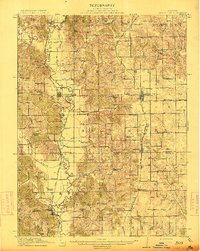
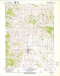
Historical Maps of Queen City Through Time
4 maps found