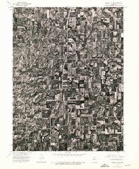
1974 Map of Queen City SE
USGS Topo · Published 1976About this map
Greentop and Sublette anchor this 1974 orthophotograph of the Adair County countryside, providing a high-altitude perspective on the agricultural patterns of northern Missouri. Unlike traditional topographic maps, this imagery, produced by the U.S. Geological Survey and the Missouri Department of Natural Resources, uses actual aerial photography to reveal the fine-grained texture of the land. The grid of cultivated fields is interrupted by the winding, wooded drainages typical of the region's dissected plains. The north-south corridor of U.S. Route 63 serves as the primary artery for the area, cutting a straight line through the undulating terrain and connecting these small communities. For those interested in land use and the specific layout of farmsteads in the mid-1970s, the map offers an unfiltered view of the rural landscape exactly as it appeared from the air.
Find a feature on this map
3 named features on this map. Tap any name to fly to it.
Don’t see what you’re looking for? This feature index may not catch every label — zoom into the map to look around manually.
Map Details
Editions of this 1974 Queen City SE Map
This is the sole edition of this map. No revisions or reprints were ever made.
Other maps of this area

1903 · Edina
USGS Topo · 1:125,000

1911 · Queen City
USGS Topo · 1:62,500

1913 · Queen City
USGS Topo · 1:62,500

1938 · Kirksville
USGS Topo · 1:62,500

1940 · Kirksville
USGS Topo · 1:62,500

1954 · Centerville
USGS Topo · 1:250,000

1957 · Centerville
USGS Topo · 1:250,000

1958 · Centerville
USGS Topo · 1:250,000

1965 · Downing NW
USGS Topo · 1:24,000

1966 · Brashear
USGS Topo · 1:24,000