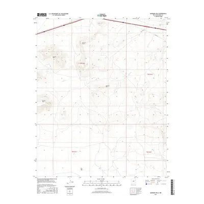
2017 Map of Quemado Hills
USGS Topo · Published 2017About this map
Rte 66 cuts across the northern edge of this high-plains landscape, tracing the historic corridor through the eastern New Mexico territory. This 2017 survey reveals a terrain defined by significant mesas and isolated rises, including the Palomas Hills and Mesa del Puerta. The drainage patterns of Blanca Cr and Plaza Larga Cr weave through the southern half of the quadrangle, which is anchored by the wide expanse of Ogle Flat. Local transportation routes like Quay Road Ay connect these cattle-ranching uplands, where the Quemado Hills and Palomas Mesa provide prominent landmarks for navigation across the open range. The map documents the precise township and range boundaries that have organized this landscape since the early days of settlement.
Find a feature on this map
15 named features on this map. Tap any name to fly to it.
Don’t see what you’re looking for? This feature index may not catch every label — zoom into the map to look around manually.
Map Details
Editions of this 2017 Quemado Hills Map
This is the sole edition of this map. No revisions or reprints were ever made.
Other maps of this area

1930 · Tucumcari
USGS Topo · 1:125,000

1954 · Santa Fe
USGS Topo · 1:250,000

1954 · Fort Sumner
USGS Topo · 1:250,000

1954 · Tucumcari
USGS Topo · 1:250,000

1954 · Clovis
USGS Topo · 1:250,000

1958 · Fort Sumner
USGS Topo · 1:250,000

1958 · Santa Fe
USGS Topo · 1:250,000

1958 · Clovis
USGS Topo · 1:250,000

1958 · Tucumcari
USGS Topo · 1:250,000

1964 · Muniz Canyon
USGS Topo · 1:24,000