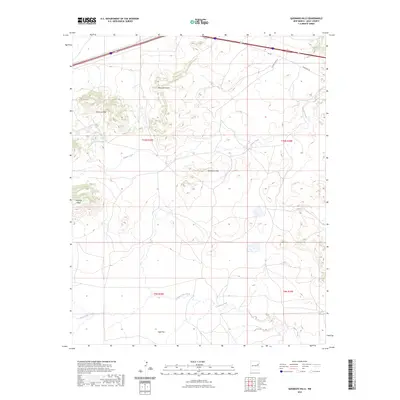
2023 Map of Quemado Hills
USGS Topo · Published 2023About this map
Quemado Hills and the adjacent Palomas Mesa define the high-desert topography of this region in Quay County. The landscape is carved by seasonal drainage systems, including Blanca Creek and Plaza Larga Creek, which dictate the placement of ranch roads and remote settlements like Ogle Flat. Modern infrastructure cuts through the northern edge of this high-plains terrain, where Rte 66 and a series of frontage roads parallel the interstate corridor.
Find a feature on this map
15 named features on this map. Tap any name to fly to it.
Don’t see what you’re looking for? This feature index may not catch every label — zoom into the map to look around manually.
Map Details
Editions of this 2023 Quemado Hills Map
This is the sole edition of this map. No revisions or reprints were ever made.
Other maps of this area

1930 · Tucumcari
USGS Topo · 1:125,000

1954 · Santa Fe
USGS Topo · 1:250,000

1954 · Fort Sumner
USGS Topo · 1:250,000

1954 · Tucumcari
USGS Topo · 1:250,000

1954 · Clovis
USGS Topo · 1:250,000

1958 · Fort Sumner
USGS Topo · 1:250,000

1958 · Santa Fe
USGS Topo · 1:250,000

1958 · Clovis
USGS Topo · 1:250,000

1958 · Tucumcari
USGS Topo · 1:250,000

1964 · Muniz Canyon
USGS Topo · 1:24,000