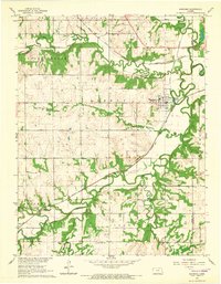
1965 Map of Quenemo
USGS Topo · Published 1966About this map
Quenemo sits at the convergence of several major waterways and transportation lines in this mid-1960s survey of eastern Osage County. The Marais des Cygnes River meanders through the southern half of the landscape, joined by numerous tributaries including Salt Creek, Hundred and Ten Mile Creek, and Dry Creek. The town is a rail hub for the Atchison Topeka and Santa Fe and the Missouri Pacific, while traces of an Old Railroad Grade north of town suggest earlier infrastructure. Local genealogy is well-supported by several burial sites, including Curry Cem, Oak Hill Cem, Sutton Cem, and Pleasant View Cem. The landscape is largely defined by the townships of Valley Brook, Agency, and Melvern, showing a rural character marked by a network of quarries and a Gaging Station monitoring the river's flow near the Franklin County line.
Find a feature on this map
26 named features on this map. Tap any name to fly to it.
Don’t see what you’re looking for? This feature index may not catch every label — zoom into the map to look around manually.
Map Details
Editions of this 1965 Quenemo Map
This is the sole edition of this map. No revisions or reprints were ever made.
Other maps of this area

1885 · Burlington
USGS Topo · 1:125,000

1885 · Garnett
USGS Topo · 1:125,000

1885 · Lawrence
USGS Topo · 1:125,000

1889 · Burlingame
USGS Topo · 1:125,000

1889 · Lawrence
USGS Topo · 1:125,000

1894 · Garnett
USGS Topo · 1:125,000

1894 · Burlingame
USGS Topo · 1:125,000

1894 · Burlington
USGS Topo · 1:125,000

1947 · Lawrence
USGS Topo · 1:250,000

1950 · Lawrence
USGS Topo · 1:250,000