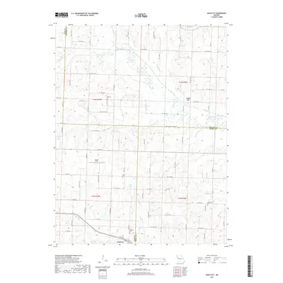
2017 Map of Quick City
USGS Topo · Published 2017About this map
Big Creek and its many tributaries, including Panther Cr and Little Walnut Cr, define the drainage patterns where Cass, Johnson, and Henry counties converge. This 2017 study illustrates a predominantly agricultural landscape punctuated by small, scattered settlements and numerous family and community burial grounds. Genealogy researchers will find several well-marked sites, such as Pemberton Cem, Grant Cem, Page Cem, and Hendricks Cem, reflecting the early settlement history of the region. The map captures Quick City at a crossroads of county roads, while Creighton sits to the southwest. Of particular interest is the Old Channel Big Cr, indicating a history of stream migration or human-led channelization in these bottomlands. Local transportation is supported by a dense grid of range and township roads, alongside specialized landmarks like the Flying G Airport.
Find a feature on this map
86 named features on this map. Tap any name to fly to it.
Don’t see what you’re looking for? This feature index may not catch every label — zoom into the map to look around manually.
Map Details
Editions of this 2017 Quick City Map
This is the sole edition of this map. No revisions or reprints were ever made.
Other maps of this area

1885 · Warrensburg
USGS Topo · 1:125,000

1887 · Clinton
USGS Topo · 1:125,000

1887 · Harrisonville
USGS Topo · 1:125,000

1887 · Butler
USGS Topo · 1:125,000

1887 · Warrensburg
USGS Topo · 1:125,000

1892 · Harrisonville
USGS Topo · 1:125,000

1894 · Harrisonville
USGS Topo · 1:125,000

1894 · Butler
USGS Topo · 1:125,000

1894 · Warrensburg
USGS Topo · 1:125,000

1894 · Clinton
USGS Topo · 1:125,000