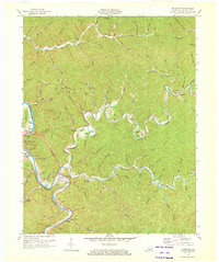
1972 Map of Quicksand
USGS Topo · Published 1973About this map
Quicksand Creek winds through the heart of this Breathitt County landscape, where the Louisville and Nashville railroad follows the river bends through Quicksand and south toward Kragon. This 1970s revision captures the region's complex economic character, from the extensive gas wells and coal mines dotting the hollows to the Univ of Kentucky Experimental Farm near the riverbanks. The settlement of Jackson anchors the western edge, featuring the LBJ Sch and a drive-in theater near Panbowl Lake.
Find a feature on this map
97 named features on this map. Tap any name to fly to it.
Don’t see what you’re looking for? This feature index may not catch every label — zoom into the map to look around manually.
Map Details
Editions of this 1972 Quicksand Map
2 editions found
Other maps of this area

1889 · Salyersville
USGS Topo · 1:125,000

1891 · Hazard
USGS Topo · 1:125,000

1891 · Salyersville
USGS Topo · 1:125,000

1899 · Salyersville
USGS Topo · 1:125,000

1913 · Buckhorn
USGS Topo · 1:62,500

1914 · Troublesome
USGS Topo · 1:62,500

1951 · Guage
USGS Topo · 1:24,000

1951 · Landsaw
USGS Topo · 1:24,000

1951 · Seitz
USGS Topo · 1:24,000

1951 · Quicksand
USGS Topo · 1:24,000