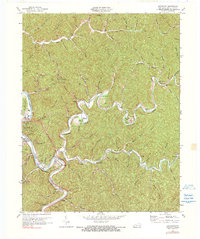
1972 Map of Quicksand
USGS Topo · Published 1990About this map
Jackson sits along the bend of the Kentucky River, serving as a focal point for this 1970s look at Breathitt County's central corridor. The landscape is defined by the tight meanders of Quicksand Creek and the South Fork, where narrow valleys host a network of small settlements like Quicksand, Noctor, and Portsmouth. The industrial footprint of the era is evident in the numerous mines, gas wells, and oil wells scattered across ridges such as Roark Ridge and Bald Hill.
Find a feature on this map
82 named features on this map. Tap any name to fly to it.
Don’t see what you’re looking for? This feature index may not catch every label — zoom into the map to look around manually.
Map Details
Editions of this 1972 Quicksand Map
2 editions found
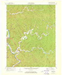
Other maps of this area

1889 · Salyersville
USGS Topo · 1:125,000

1891 · Hazard
USGS Topo · 1:125,000

1891 · Salyersville
USGS Topo · 1:125,000

1899 · Salyersville
USGS Topo · 1:125,000

1913 · Buckhorn
USGS Topo · 1:62,500

1914 · Troublesome
USGS Topo · 1:62,500

1951 · Guage
USGS Topo · 1:24,000

1951 · Landsaw
USGS Topo · 1:24,000

1951 · Seitz
USGS Topo · 1:24,000

1951 · Quicksand
USGS Topo · 1:24,000