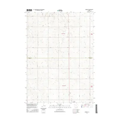
2015 Map of Quimby SE
USGS Topo · Published 2015About this map
Holstein anchors the southeastern corner of this rural landscape, marking a center of commerce and community at the edge of the Ida Co line. The terrain is defined by the winding paths of Silver Cr and Fourmile Cr, which dictate the local topography and the placement of early farmsteads. Evidence of pioneer-era heritage is preserved at Silver Cem and Holstein Cem, providing significant points of interest for genealogical research. The map illustrates a highly organized township-and-range system, where a network of gravel roads like Co Rd D15 and Co Hwy M25 connects isolated agricultural properties across the Cherokee Co border. This survey demonstrates how the 19th-century grid system remains the dominant framework for transport and land use in the modern Iowa corn belt.
Find a feature on this map
38 named features on this map. Tap any name to fly to it.
Don’t see what you’re looking for? This feature index may not catch every label — zoom into the map to look around manually.
Map Details
Editions of this 2015 Quimby SE Map
This is the sole edition of this map. No revisions or reprints were ever made.
Other maps of this area

1954 · Fort Dodge
USGS Topo · 1:250,000

1957 · Fort Dodge
USGS Topo · 1:250,000

1958 · Fort Dodge
USGS Topo · 1:250,000

1967 · Holstein
USGS Topo · 1:24,000

1967 · Ida Grove NW
USGS Topo · 1:24,000

1969 · Aurelia
USGS Topo · 1:24,000

1969 · Cherokee South
USGS Topo · 1:24,000

1969 · Galva
USGS Topo · 1:24,000

1969 · Cushing
USGS Topo · 1:24,000

1969 · Quimby SE
USGS Topo · 1:24,000