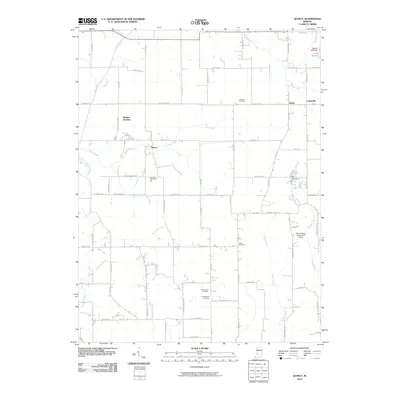
2010 Map of Quincy
USGS Topo · Published 2010About this map
Wallace Junction and the small community of Quincy serve as the focal points for this rural landscape in western Morgan County. The area is defined by a dense network of country roads such as County Line Rd and Lewisville Rd, which connect small settlements like Lewisville and Alaska. Numerous local heritage sites are preserved here, including Mannan Cemetery, Combes Cemetery, and Asher Cemetery, providing valuable points of interest for genealogical research. The terrain is drained by several winding waterways, including Brush Creek and Indian Creek, while the Shenandoah Flying Field Airport marks a modern utility in this predominantly agricultural region. To the north, Lake Maxine and its associated dam represent the local water management and recreation patterns of the early 21st century.
Find a feature on this map
78 named features on this map. Tap any name to fly to it.
Don’t see what you’re looking for? This feature index may not catch every label — zoom into the map to look around manually.
Map Details
Editions of this 2010 Quincy Map
This is the sole edition of this map. No revisions or reprints were ever made.
Other maps of this area

1947 · Gosport
USGS Topo · 1:24,000

1949 · Quincy
USGS Topo · 1:24,000

1950 · Gosport
USGS Topo · 1:24,000

1953 · Indianapolis
USGS Topo · 1:250,000

1955 · Hall
USGS Topo · 1:24,000

1956 · Indianapolis
USGS Topo · 1:250,000

1956 · Cloverdale
USGS Topo · 1:24,000

1956 · Cataract
USGS Topo · 1:24,000

1956 · Eminence
USGS Topo · 1:24,000
1956 · Spencer
USGS Topo · 1:24,000