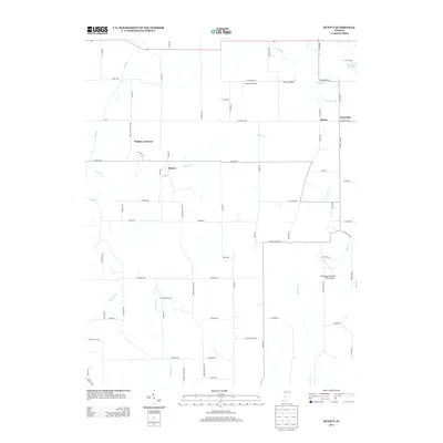
2013 Map of Quincy
USGS Topo · Published 2013About this map
Quincy and Wallace Junction anchor this rural landscape in central Indiana, where the terrain is defined by a dense network of watercourses and small-scale aviation fields. The settlement pattern follows established county roads such as Lewisville Rd and Quincy Rd, connecting the hamlet of Alaska to Lewisville. Water features are prominent throughout the quadrangle, with Brush Cr and Mill Cr winding through the northern sections while Indian Cr and Limestone Cr drain the southern reaches. A notable concentration of private airstrips, including Jack Oak Airport, Shearer Airport, and the Shenandoah Flying Field Airport, suggests a local culture tied to general aviation amidst the agricultural fields. The map also captures several family-named landmarks like Lake Maxine, providing specific points of interest for local historians and genealogists tracing the development of this region.
Find a feature on this map
76 named features on this map. Tap any name to fly to it.
Don’t see what you’re looking for? This feature index may not catch every label — zoom into the map to look around manually.
Map Details
Editions of this 2013 Quincy Map
This is the sole edition of this map. No revisions or reprints were ever made.
Other maps of this area

1947 · Gosport
USGS Topo · 1:24,000

1949 · Quincy
USGS Topo · 1:24,000

1950 · Gosport
USGS Topo · 1:24,000

1953 · Indianapolis
USGS Topo · 1:250,000

1955 · Hall
USGS Topo · 1:24,000

1956 · Indianapolis
USGS Topo · 1:250,000

1956 · Cloverdale
USGS Topo · 1:24,000

1956 · Cataract
USGS Topo · 1:24,000

1956 · Eminence
USGS Topo · 1:24,000
1956 · Spencer
USGS Topo · 1:24,000