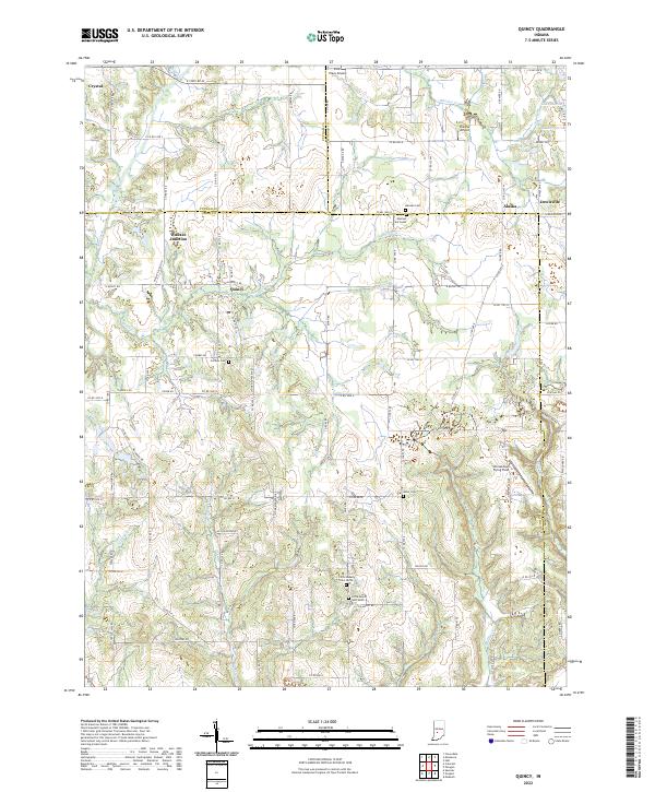
2022 Map of Quincy
USGS Topo · Published 2022About this map
Quincy and Wallace Junction anchor this part of Owen County where the local rail network meets the rolling landscape of south-central Indiana. The area is defined by a dense concentration of small family and community burial grounds, including Mannan Cem, Combes Cem, and both the north and south sections of Little Mount Cem. These sites, often situated near winding watercourses like Brush Cr and Mill Creek, offer significant points of interest for genealogical research.
Find a feature on this map
100 named features on this map. Tap any name to fly to it.
Don’t see what you’re looking for? This feature index may not catch every label — zoom into the map to look around manually.
Map Details
Editions of this 2022 Quincy Map
This is the sole edition of this map. No revisions or reprints were ever made.
Other maps of this area

1947 · Gosport
USGS Topo · 1:24,000

1949 · Quincy
USGS Topo · 1:24,000

1950 · Gosport
USGS Topo · 1:24,000

1953 · Indianapolis
USGS Topo · 1:250,000

1955 · Hall
USGS Topo · 1:24,000

1956 · Indianapolis
USGS Topo · 1:250,000

1956 · Cloverdale
USGS Topo · 1:24,000

1956 · Cataract
USGS Topo · 1:24,000

1956 · Eminence
USGS Topo · 1:24,000
1956 · Spencer
USGS Topo · 1:24,000