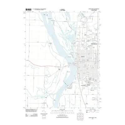
2012 Map of Quincy West
USGS Topo · Published 2012About this map
The Mississippi River dominates this landscape, weaving between a series of large islands including Hogback Island, Quinsippi Island, and Poage Island. On the eastern bank, the urban grid of Quincy extends toward the riverfront, marked by prominent institutions such as Quincy University and the Quincy College North Campus. The transport network is defined by the Quincy Memorial Bridge and the modern Bay View Bridge, connecting Illinois to West Quincy, Missouri.
Find a feature on this map
160 named features on this map. Tap any name to fly to it.
Don’t see what you’re looking for? This feature index may not catch every label — zoom into the map to look around manually.
Map Details
Editions of this 2012 Quincy West Map
This is the sole edition of this map. No revisions or reprints were ever made.
Other maps of this area
1903 · Kahoka
USGS Topo · 1:125,000
1903 · Palmyra
USGS Topo · 1:125,000
1925 · Quincy
USGS Topo · 1:62,500
1944 · Quincy
USGS Topo · 1:62,500
1945 · Quincy
USGS Topo · 1:62,500
1946 · Mendon
USGS Topo · 1:62,500
1948 · Quincy
USGS Topo · 1:250,000
1948 · Mendon
USGS Topo · 1:62,500
1949 · Maywood
USGS Topo · 1:24,000
1949 · Palmyra
USGS Topo · 1:24,000