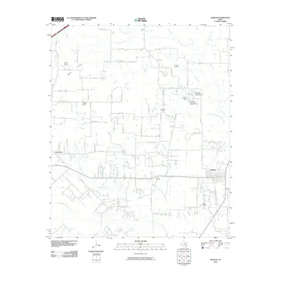
2010 Map of Quinlan
USGS Topo · Published 2010About this map
The South Fork Sabine River basin defines the southern reaches of this landscape, where numerous tributaries like Bearpen Creek and Sandy Creek drain toward the river. The settlement of Quinlan serves as the primary hub of activity in the east, while Union Valley anchors the west. The rural character of the area is underscored by a distributed network of family-named landmarks and resting places, including Graham Point Cemetery, Paynetown Cemetery, and Hodges Cemetery.
Find a feature on this map
67 named features on this map. Tap any name to fly to it.
Don’t see what you’re looking for? This feature index may not catch every label — zoom into the map to look around manually.
Map Details
Editions of this 2010 Quinlan Map
This is the sole edition of this map. No revisions or reprints were ever made.
Other maps of this area

1919 · Royse City
USGS Topo · 1:62,500

1930 · Farmersville
USGS Topo · 1:62,500

1954 · Dallas
USGS Topo · 1:250,000

1954 · Sherman
USGS Topo · 1:250,000

1956 · Quinlan
USGS Topo · 1:62,500

1958 · Dallas
USGS Topo · 1:250,000

1958 · Sherman
USGS Topo · 1:250,000

1962 · Greenville SW
USGS Topo · 1:24,000

1962 · Greenville SE
USGS Topo · 1:24,000
1962 · Terrell North
USGS Topo · 1:24,000