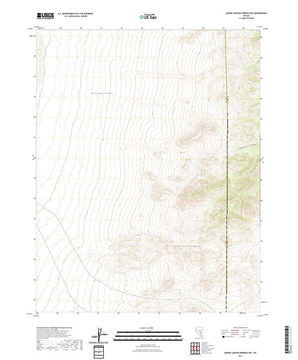
2021 Map of Quinn Canyon Springs NW
USGS Topo · Published 2021About this map
Quinn Canyon Range dominates the southern landscape of this high-desert region, where the steep topography of the mountains gives way to the broad alluvial expanse of Railroad Valley in the north. This transition zone is punctuated by vital water sources such as Seeps Spring and Trough Spring, which have long served as critical points for surveyors and travelers navigating this arid portion of the Great Basin. The map also delineates the high-altitude terrain of Moonshine Canyon and follows the county boundary line dividing Nye and Lincoln counties. The lack of modern development emphasizes the remote character of the basin-and-range geography, defined by complex contour lines and the Public Land Survey System grids including t1n r54e and t2n r54e.
Find a feature on this map
12 named features on this map. Tap any name to fly to it.
Don’t see what you’re looking for? This feature index may not catch every label — zoom into the map to look around manually.
Map Details
Editions of this 2021 Quinn Canyon Springs NW Map
This is the sole edition of this map. No revisions or reprints were ever made.
Other maps of this area

1908 · Kawich
USGS Topo · 1:250,000

1942 · Reveille Peak
USGS Topo · 1:125,000

1942 · Penoyer Valley
USGS Topo · 1:125,000

1952 · Reveille Peak
USGS Topo · 1:62,500

1954 · Caliente
USGS Topo · 1:250,000

1954 · Goldfield
USGS Topo · 1:250,000

1955 · Goldfield
USGS Topo · 1:250,000

1956 · Lund
USGS Topo · 1:250,000

1956 · Tonopah
USGS Topo · 1:250,000

1958 · Goldfield
USGS Topo · 1:250,000